
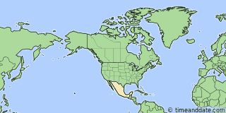
| Country: | Mexico |
|---|---|
| Lat/Long: | 19°41'N / 88°07'W |
| Currency: | Mexican Peso (MXN) |
| Languages: | Spanish, Nahuatl, Yucatec Maya, … |
| Country Code: | N/A |


Holiday Note: Nov 16, Revolution Day Memorial. Businesses may be closed. See more
°F


Weather
81 °F
Sprinkles. Overcast.
83 / 72 °F
| Sun 15. |

|
85 / 73 °F |
| Mon 16. |
|
87 / 74 °F |
Weather by CustomWeather, © 2026


More Sun & Moon in 19°41'09.4"N, 88°06'37.8"W
+ Show More Twilight and Moon Phase Information
Solar Noon
Sun in South: 12:36 pm
Altitude: 52.2°
Altitude: 52.2°
Astronomical
Twilight
5:43 am – 6:10 am
7:03 pm – 7:29 pm
7:03 pm – 7:29 pm
Nautical
Twilight
6:10 am – 6:36 am
6:36 pm – 7:03 pm
6:36 pm – 7:03 pm
Civil
Twilight
6:36 am – 6:59 am
6:13 pm – 6:36 pm
6:13 pm – 6:36 pm
Previous
Moon Phase
New Moon
November 9, 2026
2:02 am
November 9, 2026
2:02 am
Next
Moon Phase
First Quarter
November 17, 2026
6:47 am
November 17, 2026
6:47 am

Calendar & Holidays
Upcoming Holidays

Airports
- Chetumal International Airport, CTM
About 82 mi S of 19°41'09.4"N, 88°06'37.8"W - San Pedro, SPR (Belize)
About 122 mi S of 19°41'09.4"N, 88°06'37.8"W - Philip S. W. Goldson International Airport, BZE (Belize)
About 148 mi S of 19°41'09.4"N, 88°06'37.8"W - Cancún International Airport, CUN
About 123 mi NE of 19°41'09.4"N, 88°06'37.8"W


19°41'09.4"N, 88°06'37.8"W
Mexico
10:49
28
pm
Friday, November 13, 2026