
| Country: | United States |
|---|---|
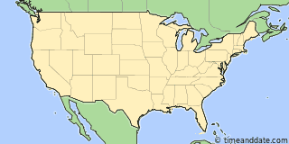
| Lat/Long: | 32°51'N / 114°28'W |
| Currency: | United States Dollar (USD) |
| Languages: | English |
| Country Code: | N/A |

°F


Weather
69 °F
Sunny.
72 / 53 °F
| Sat 21. |

|
72 / 53 °F |
| Sun 22. |

|
72 / 49 °F |
Weather by CustomWeather, © 2026


More Sun & Moon in 32°51'18.3"N, 114°27'45.6"W
+ Show More Twilight and Moon Phase Information
Solar Noon
Sun in South: 12:23 pm
Altitude: 37.3°
Altitude: 37.3°
Astronomical
Twilight
5:46 am – 6:16 am
6:30 pm – 6:59 pm
6:30 pm – 6:59 pm
Nautical
Twilight
6:16 am – 6:46 am
6:00 pm – 6:30 pm
6:00 pm – 6:30 pm
Civil
Twilight
6:46 am – 7:12 am
5:33 pm – 6:00 pm
5:33 pm – 6:00 pm
Previous
Moon Phase
First Quarter
November 17, 2026
4:47 am
November 17, 2026
4:47 am
Next
Moon Phase
Full Moon
November 24, 2026
7:53 am
November 24, 2026
7:53 am


Airports
- YUMA/YUMA MCAS.YUMA INTL,AZ., YUM
About 16 mi SSW of 32°51'18.3"N, 114°27'45.6"W - General Rodolfo Sánchez Taboada International Airport, MXL (Mexico)
About 48 mi WSW of 32°51'18.3"N, 114°27'45.6"W - Phoenix Sky Harbor International Airport, PHX
About 148 mi ENE of 32°51'18.3"N, 114°27'45.6"W


32°51'18.3"N, 114°27'45.6"W
USA
5:43
16
pm
Friday, November 20, 2026