
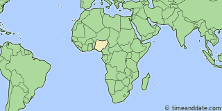
| Country: | Nigeria |
|---|---|
| Lat/Long: | 8°13'N / 6°42'E |
| Currency: | Naira (NGN) |
| Languages: | English |
| Country Code: | N/A |

°F


Weather
N/A
Conditions not available.
| Sat 21. |

|
103 / 67 °F |
| Sun 22. |

|
103 / 71 °F |
Weather by CustomWeather, © 2026


More Sun & Moon in 8°12'35.1"N, 6°41'30.9"E
+ Show More Twilight and Moon Phase Information
Solar Noon
Sun in South: 12:18 pm
Altitude: 62.1°
Altitude: 62.1°
Astronomical
Twilight
5:13 am – 5:39 am
6:58 pm – 7:23 pm
6:58 pm – 7:23 pm
Nautical
Twilight
5:39 am – 6:04 am
6:32 pm – 6:58 pm
6:32 pm – 6:58 pm
Civil
Twilight
6:04 am – 6:27 am
6:10 pm – 6:32 pm
6:10 pm – 6:32 pm
Previous
Moon Phase
First Quarter
November 17, 2026
12:47 pm
November 17, 2026
12:47 pm
Next
Moon Phase
Full Moon
November 24, 2026
3:53 pm
November 24, 2026
3:53 pm

Calendar & Holidays
Upcoming Holidays

Airports
- Nnamdi Azikiwe International Airport, ABV
About 67 mi NE of 8°12'35.1"N, 6°41'30.9"E - Akanu Ibiam International Airport, ENU
About 133 mi SSE of 8°12'35.1"N, 6°41'30.9"E - Murtala Muhammed International Airport, LOS
About 257 mi WSW of 8°12'35.1"N, 6°41'30.9"E - Benin Airport, BNI
About 150 mi SSW of 8°12'35.1"N, 6°41'30.9"E


8°12'35.1"N, 6°41'30.9"E
Nigeria
2:42
59
am
Friday, November 20, 2026